Journal Publication release
"Colour to Greyscale Pixels: Re-seeing Greyscale Archived Aerial Photographs and Declassified Satellite CORONA Images Based on Image Fusion Techniques", Archaeological Prospection, DOI: 10.1002/arp.1536. (more…)
"Colour to Greyscale Pixels: Re-seeing Greyscale Archived Aerial Photographs and Declassified Satellite CORONA Images Based on Image Fusion Techniques", Archaeological Prospection, DOI: 10.1002/arp.1536. (more…)
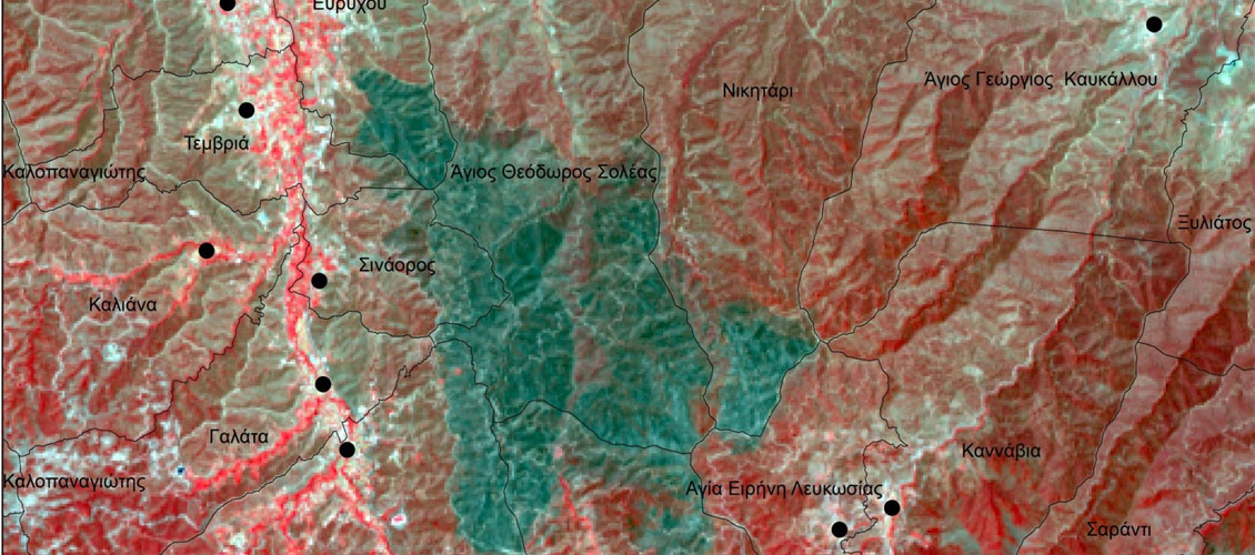
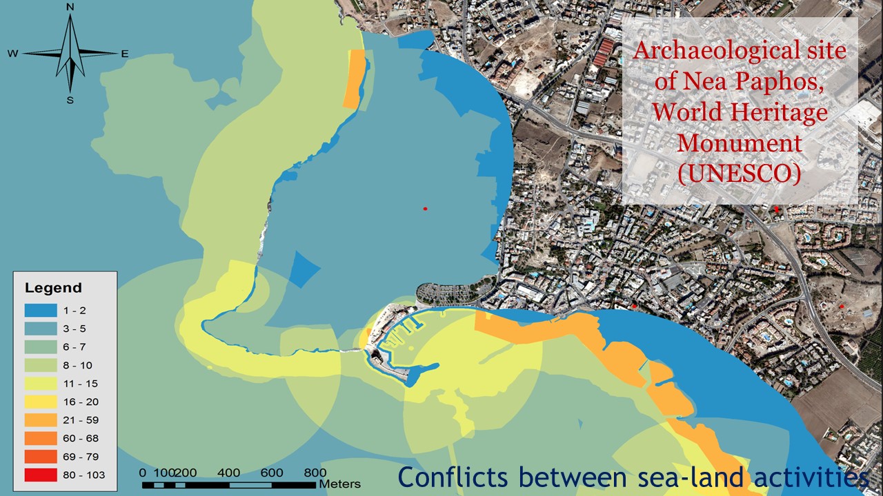
CUT members staff from the ATHENA project have been recently involved in the preparation of post-fire maps and analysis of multispectral satellite images in the wider area of Solea region, in the vicinity of Cultural Heritage Sites and Monuments, included UNESCO World Heritage Sites. (more…)
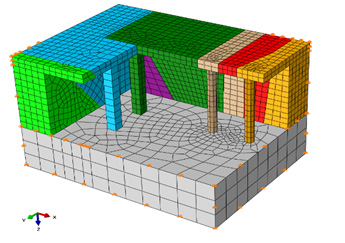
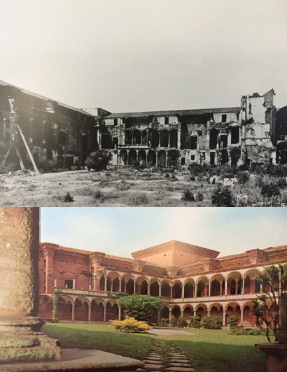
"Correlating damage condition with historical seismic activity in underground sepulchral monuments of Cyprus", Journal of Archaeological Science: Reports, doi:10.1016/j.jasrep.2016.07.007 . (more…)
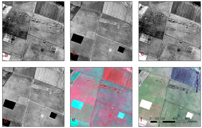
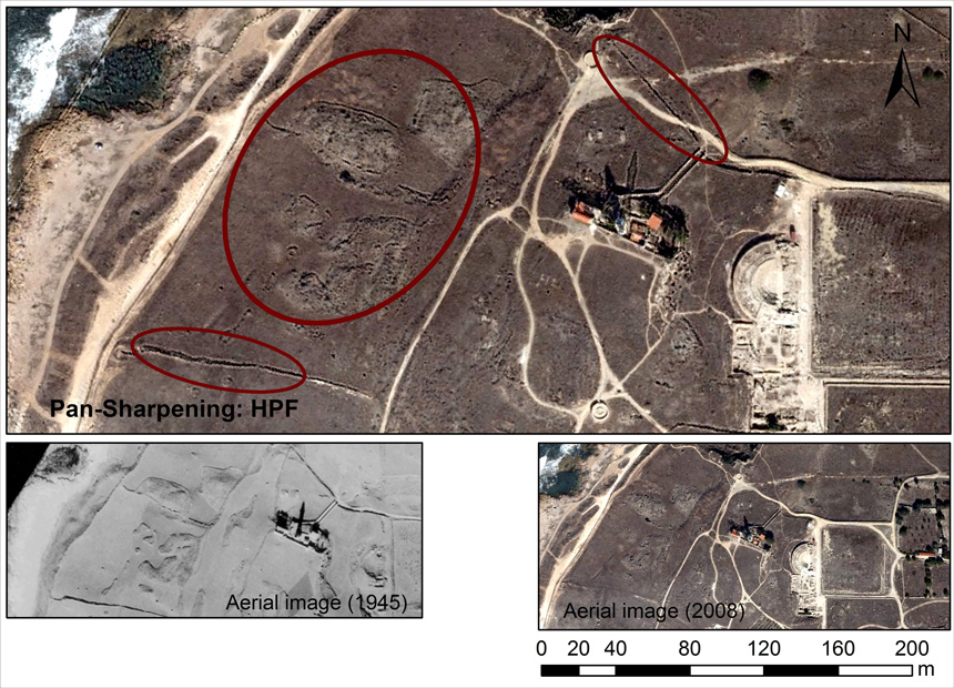
"Orthogonal equations for the detection of hidden archaeological remains de-mystified", Journal of Archaeological Science: Reports, doi:10.1016/j.jasrep.2016.07.004 (more…)
ATHENA supports the PhD Summer School course “Surveying Modelling Monitoring Management BIM-GIS based: Cultural Heritage & Built Environment” (19-22 July, 2016). The course is organized by Politecnico di Milano, dABC with Visiting Lecturers from Carleton University (Canada), FORTH Institute (Greece) and Cyprus University of Technology (Cyprus). Dr. Branka Cuca from CUT will present the session “Societal Challenges, Copernicus Programme Opportunities & Archaeolandscape”. Read more here.
ATHENA project was presented during the invited lecture of Dr. Athos Agapiou at the Hellenic Maritime Museum, Piraeus, Greece organized in the framework of the the FP7 ITACA Final Conference. Details regarding the program of the conference can be found here.
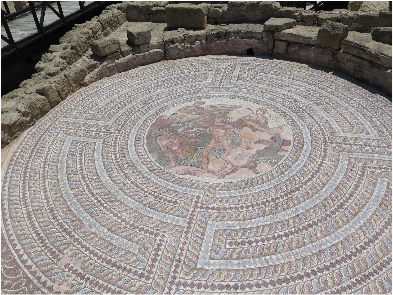
"Towards a spectral library of Roman to Early Christian Cypriot floor mosaics", Journal of Archaeological Science: Reports, doi:10.1016/j.jasrep.2016.06.029 (more…)
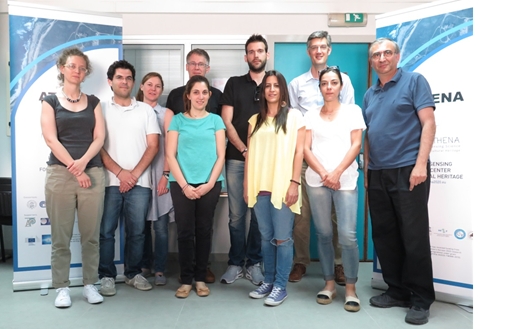
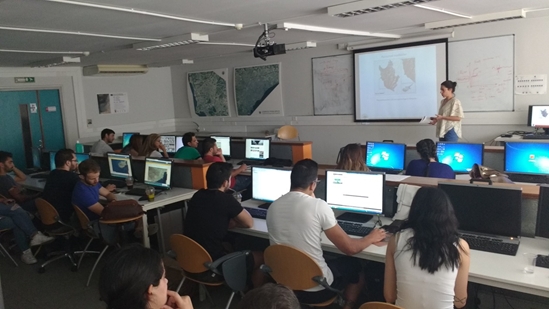
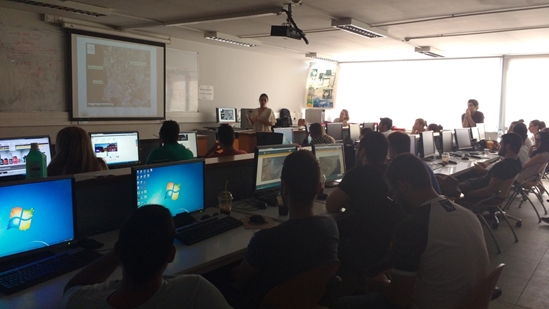
The first ATHENA Summer School was held in the premises of Cyprus University of Technology in the Remote Sensing and Geoenviroment Lab of “Eratosthenes”. Prof. Dr. Michael Eineder from DLR/TUM presented the Synthetic Aperture Radar (SAR) Principles and Applications while Dr. Ramon Brcic presented TerraSAR-X Data, SAR Sentinel-1 Data, ERS-ENVISAT-Data and SAR data availability for Paphos Testsite as well SAR Data Evaluation. (more…)
ATHENA project presented to undergraduate students of the Department of Civil Engineering and Geomatics (Cyprus University of Technology) during the summer courses (1/6/2016).